Restaurant nearby Delēkárēs
Greece
Restaurant nearby Delēkárēs
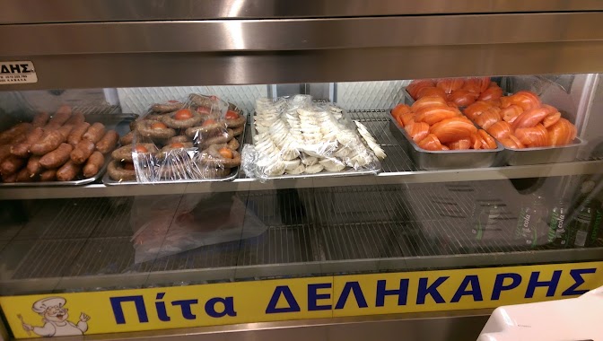
Delēkárēs
8, Psaron, 653 02, Kavala, GR Griechenland
contacts phone
:
+30 251 023 2116
Latitude:
40.9369023
, Longitude:
24.4131019
larger map & directions
read more
nearest Restaurant
12 m
Ouzepi stou Mnva
Psaron 15, Kavala
Restaurant
read more
13 m
Drachmoula
Spetson 9, Kavala
Restaurant
read more
14 m
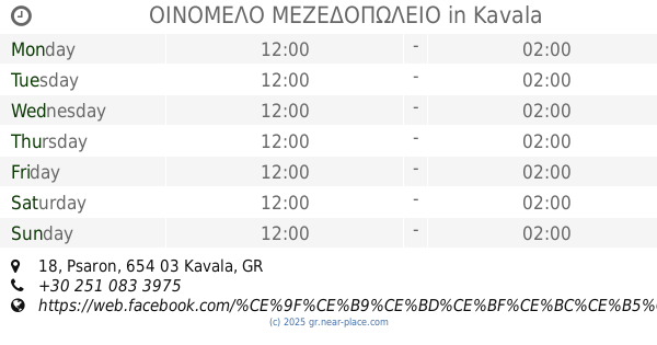
ΟΙΝΟΜΕΛΟ ΜΕΖΕΔΟΠΩΛΕΙΟ
Psaron 18, Kavala
Restaurant
read more
23 m
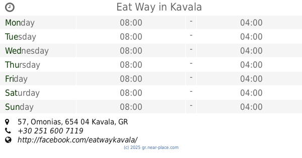
Eat Way
Omonias 57, Kavala
Restaurant
read more
23 m
Kavalas Best Gyros
Δοιράνης, Ομόνοιας, Kavala
Restaurant
read more
46 m
Bosporos
Spetson 17, Kavala
Restaurant
read more
56 m
Mermaids And Guys
Ellis 2-10, Kavala
Restaurant
read more
61 m
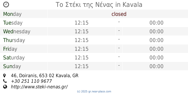
Το Στέκι της Νένας
Doiranis 46, Kavala
Restaurant
read more
88 m
Soúsouro
Agiou Nikolaou 4, Kavala
Restaurant
read more
108 m
Πανεψηστήμιον Γυράδικο
16, Amynta 22, Kavala
Restaurant
read more
118 m
Bitte Fate
Parodos Omonias 2, Kavala
Restaurant
read more
128 m
Fresco Bakery
Dragoumi 21, Kavala
Restaurant
read more
136 m
Theofilos
Ermou 16, Kavala
Restaurant
read more
200 m
Η Ωραία Μυτιλήνη, Orea Mitilini
ΠΛ. ΚΑΡΑΟΛΗ ΔΗΜΗΤΡΙΟΥ 36, Kavala
Restaurant
read more
208 m
ΠΑΝΟΣ -ΖΑΦΕΙΡΑ
Dimitriou 20, Καβάλα
Restaurant
read more
355 m
Napolitana
Averof 3, Kavala
Restaurant
read more
45.743 km
Zesti Folia
Xanthi
Restaurant
read more
45.913 km
Salt and Pepper
Θερμοπυλών 19, Xanthi
Restaurant
read more
46.293 km
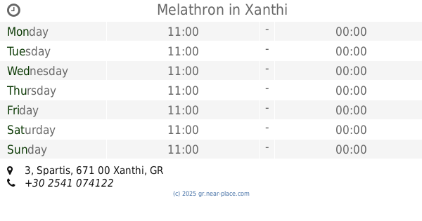
Melathron
Spartis 3, Xanthi
Restaurant
read more
49.597 km
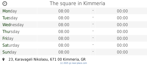
The square
Karavageli Nikolaou 23, Kimmeria
Restaurant
read more
49.707 km
Eilikríneia
Agiou Dimitriou 2, Kimmeria
Restaurant
read more
50.081 km
Ayhan
Megalou Aleksandrou 15, Kimmeria
Restaurant
read more
50.184 km
Corner
Salaminos 20, Kimmeria
Restaurant
read more
50.279 km
Ta Dio Aderfia
Posidonos 28, Kimmeria
Restaurant
read more
53.398 km
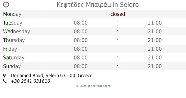
Κεφτέδες Μπαιράμ
Unnamed Road, Selero
Restaurant
read more
📑
all categories
Accounting
Administrative area level 1
Administrative area level 2
Airport
Amusement park
Aquarium
Art gallery
Atm
Bakery
Bank
Bar
Beauty salon
Bicycle store
Book store
Bowling alley
Bus station
Cafe
Campground
Car dealer
Car rental
Car repair
Car wash
Casino
Cemetery
Church
City hall
Clothing store
Convenience store
Country
Courthouse
Dentist
Department store
Doctor
Electrician
Electronics store
Embassy
Establishment
Finance
Fire station
Florist
Food
Funeral home
Furniture store
Gas station
General contractor
Grocery or supermarket
Gym
Hair care
Hardware store
Health
Hindu Temple
Home goods store
Hospital
Insurance agency
Jewelry store
Laundry
Lawyer
Library
Light rail station
Liquor store
Local government office
Locality
Locksmith
Lodging
Meal delivery
Meal takeaway
Mosque
Movie rental
Movie theater
Moving company
Museum
Natural feature
Neighborhood
Night club
Painter
Park
Parking
Pet store
Pharmacy
Physiotherapist
Place of worship
Plumber
Point of interest
Police
Post office
Premise
Real estate agency
Restaurant
Roofing contractor
Route
Rv park, camping
School
Shoe store
Shopping mall
Spa
Stadium
Storage
Store
Subpremise
Subway station
Supermarket
Synagogue
Taxi stand
Train station
Transit station
Travel agency
University
Veterinary care
Zoo
administrative area level 3
administrative area level 4
↑