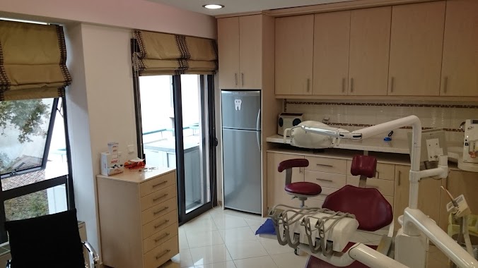
Dentist nearby Malkots Dental Clinic
Greece
Dentist nearby Malkots Dental Clinic
Malkots Dental Clinic
109, Panagi Tsaldari, 671 00, Xanthi, GR Greece
contacts phone
:
+30 2541 026483
Latitude:
41.1406718
, Longitude:
24.8916228
larger map & directions
read more
nearest Dentist
244 m
Lampeas Michalis
Θερμοπυλών 7, Xanthi
Dentist
read more
252 m
Dental Office Michael Lampeas
3rd floor, Θερμοπυλών 7, Xanthi
Dentist
read more
302 m
Dimiou Anna - MARIA - dentist - XANTHI
Πάροδος -3, Θερμοπυλών 1, Xanthi
Dentist
read more
311 m
Οδοντιατρείο Λαγογερίδη - Κουτσούμπα Δημήτρη
14, Georgiou Staurou 16, Xanthi
Dentist
read more
343 m
Dentist Apessos Julian
Dagkli 1-3, Xanthi
Dentist
read more
354 m
Οδοντίατρος Μακρυνίτσας Γ. Δημήτριος
Tsimiski 22, Xanthi
Dentist
read more
366 m
Συμεωνίδης Χ., Οδοντίατρος
Elpidos, Xanthi
Dentist
read more
443 m
Kotti Evangelia Military Surgeon Dentist
Σμύρνης 16 - Β, Xanthi
Dentist
read more
476 m
Sotiriadou Eleni- Military Surgeon Dentist
Dagkli 1-3, Xanthi
Dentist
read more
612 m
Οδοντιατρείο Νίκου Πετρίδη
Michail Karaoli 89, Xanthi
Dentist
read more
42.93 km
dental office cihat yusuf
Mpizaniou 23, Komotini
Dentist
read more
42.949 km
Dental Clinic Tzaner Kioutsouk
Marinaki 1, Komotini
Dentist
read more
42.993 km
Komotini Dental Clinic
Charilaou Trikoupi 66, Komotini
Dentist
read more
42.997 km
kosmidisdental
Andrea Papandreou 3, Komotini
Dentist
read more
43.089 km
PERIDENT
Charilaou Trikoupi 50, Komotini
Dentist
read more
43.093 km
Perident Μολλά Περιχάν
50, Charilaou Trikoupi 52, Komotini
Dentist
read more
43.101 km
ESDental Clinic
Vasileou Pavlou 7, Komotini
Dentist
read more
46.131 km
Leonidas Efthimiadis - Dental Care
Vroutou 25, Kavala
Dentist
read more
46.283 km
Cetin Simeon
Ethnarchou Makariou 12, Kavala
Dentist
read more
47.765 km
Tornikidis Michael - Dental
Menandrou 17, Kavala
Dentist
read more
📑
all categories
Accounting
Administrative area level 1
Administrative area level 2
Airport
Amusement park
Aquarium
Art gallery
Atm
Bakery
Bank
Bar
Beauty salon
Bicycle store
Book store
Bowling alley
Bus station
Cafe
Campground
Car dealer
Car rental
Car repair
Car wash
Casino
Cemetery
Church
City hall
Clothing store
Convenience store
Country
Courthouse
Dentist
Department store
Doctor
Electrician
Electronics store
Embassy
Establishment
Finance
Fire station
Florist
Food
Funeral home
Furniture store
Gas station
General contractor
Grocery or supermarket
Gym
Hair care
Hardware store
Health
Hindu Temple
Home goods store
Hospital
Insurance agency
Jewelry store
Laundry
Lawyer
Library
Light rail station
Liquor store
Local government office
Locality
Locksmith
Lodging
Meal delivery
Meal takeaway
Mosque
Movie rental
Movie theater
Moving company
Museum
Natural feature
Neighborhood
Night club
Painter
Park
Parking
Pet store
Pharmacy
Physiotherapist
Place of worship
Plumber
Point of interest
Police
Post office
Premise
Real estate agency
Restaurant
Roofing contractor
Route
Rv park, camping
School
Shoe store
Shopping mall
Spa
Stadium
Storage
Store
Subpremise
Subway station
Supermarket
Synagogue
Taxi stand
Train station
Transit station
Travel agency
University
Veterinary care
Zoo
administrative area level 3
administrative area level 4
↑